Reliable Data You Can Trust
Reliable Data You Can Trust
A recent report published by Infinium Global Research on aerial
imaging market provides in-depth analysis of segments and sub-segments in the
global as well as regional aerial imaging market. The study also highlights the
impact of drivers, restraints, and macro indicators on the global and regional
aerial imaging market over the short term as well as long term. The report is a
comprehensive presentation of trends, forecast and dollar values of global
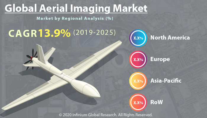
aerial imaging market. According to the report, the global aerial imaging
market is projected to grow at a CAGR of 13.9% over the forecast period of
2019-2025.
The leading players in the aerial imaging market are Google LLC,
Digital Aerial Solutions, LLC, Fugro N.V., Cooper Aerial Surveys Co., Landiscor
Aerial Information, EgaleView Technologies, Phoenix Aerial Imaging Pty Ltd.,
Quantum Spatial, Inc., BLOM ASA, 3D Robotics, and other companies. The
companies are focusing on strategies such as mergers, acquisitions, and new
product launches that stimulate their market share.
The growing adoption of drone technology drives the growth of the
aerial imaging market. Technological development and the Internet of things
contribute to the growth of the aerial imaging market. The rising number of
natural disasters and increasing demand for accurate aerial imaging devices
propel the growth of the aerial imaging market. Aerial imaging is utilized to
capture images of ground surfaces from an elevated place with the use of
cameras. Aerial imaging has a broad range of applications in various sectors
like energy, defense, government, and others. Aerial imaging helps disaster
management authorities in forecasting and managing various situations that
propel the growth of the aerial imaging market. Aerial imaging is applicable in
developing plans, maps and forecasting information for presentation of the
earth's surface. In addition, aerial imaging is combined with Geographical
Information System is used in analysis and strategic planning of urban
settlements. The hastily increasing popularity of UAVs for aerial imaging and
the ability of aerial imaging to monitor potential damage from calamities fuel
the growth of the aerial imaging market. On the other side, the rising cost of
aerial imaging devices hampers the growth of the aerial imaging market.
Moreover, growing research and development in aerial imaging create opportunities
for the growth of the aerial imaging market.
Based on geography, the global aerial imaging market is classified
into North America, Asia-Pacific, Europe, and the Rest of the World. North
America is anticipated to hold a premium share in the global aerial imaging
market. The increasing adoption of innovative technologies in North America
contributes to the growth of the aerial imaging market in North America.
Asia-Pacific region is expected to grow in the aerial imaging market with a
healthy CAGR over the forecast period. The increasing demand for aerial imaging
in disaster management application stimulates the growth of Asia-Pacific aerial
imaging market.
The report on global aerial imaging market covers segments such as
camera orientation, platform, application, and end users. On the basis of
camera orientation, the sub-markets include vertical, and oblique. On the basis
of platform, the sub-markets include manned aircraft systems, and unmanned
aircraft systems. On the basis of application, the sub-markets include
geospatial mapping, disaster management, energy and resource management,
surveillance and monitoring, and other applications. On the basis of end users,
the sub-markets include government, energy, defense, agriculture & forestry,
civil engineering & archaeology, media & entertainment, and other
end users.
The report provides profiles of the companies in the market such
as Google LLC, Digital Aerial Solutions, LLC, Fugro N.V., Cooper Aerial Surveys
Co., Landiscor Aerial Information, EgaleView Technologies, Phoenix Aerial
Imaging Pty Ltd., Quantum Spatial, Inc., BLOM ASA, 3D Robotics, and other
companies.
The report provides deep insights into the demand forecasts,
market trends, and micro and macro indicators. In addition, this report
provides insights into the factors that are driving and restraining the growth
in this market. Moreover, The IGR-Growth Matrix analysis given in the report
brings an insight into the investment areas that existing or new market players
can consider. The report provides insights into the market using analytical
tools such as Porter's five forces analysis and DRO analysis of aerial imaging
market. Moreover, the study highlights current market trends and provides
forecast from 2019-2025. We also have highlighted future trends in the market
that will affect the demand during the forecast period. Moreover, the
competitive analysis given in each regional market brings an insight into the
market share of the leading players.
Please Choose One of them.